Premise
Created as part of industry-experience capstone unit requirements, we were tasked to build a web application addressing an assigned UN Sustainable Development Goal in 4 weeks.
We were assigned Goal 11 - "to make cities and human settlements inclusive, safe, resilient and sustainable".
The project was run in an Agile environment where we followed scrum practices with regular stand-ups, sprint plannings, sprint reviews, product demonstrations and retrospectives.
Industry-trained teaching assistants and technical mentors from Bunnings Australia acted as business analysts, project-directors, or stakeholders throughout the simulated work-experience program.
The problem
New or potential commuting cyclists in Melbourne and its surrounding suburbs, often feel overwhelmed by relevant regulations and concerned about their personal safety during their trip.
These cyclists need to find safe routes while ensuring they have the appropriate gear and are acting appropriately en-route but face challenges due to
information fragmentation, absence of centralized resources for this process, and information overload.
How can we help them consolidate relevant information for making informed decisions and help them commute safely?
Target users
New and potential commuter-cyclists in Melbourne.
Root causes identified
1) Way too much fragmented information in circulation, some of which may be ambiguous or even outdated.
2) Reduced anticipation of risks due to unfamiliatrity with routes and city layouts present additional dangers.
Limitations
- Dataset scope and availability - constrained to working with only open/public data.
- Solutions MUST be data-driven and/or involve the use of data. Functions like forums and review systems were also not allowed.
Proposed solutions
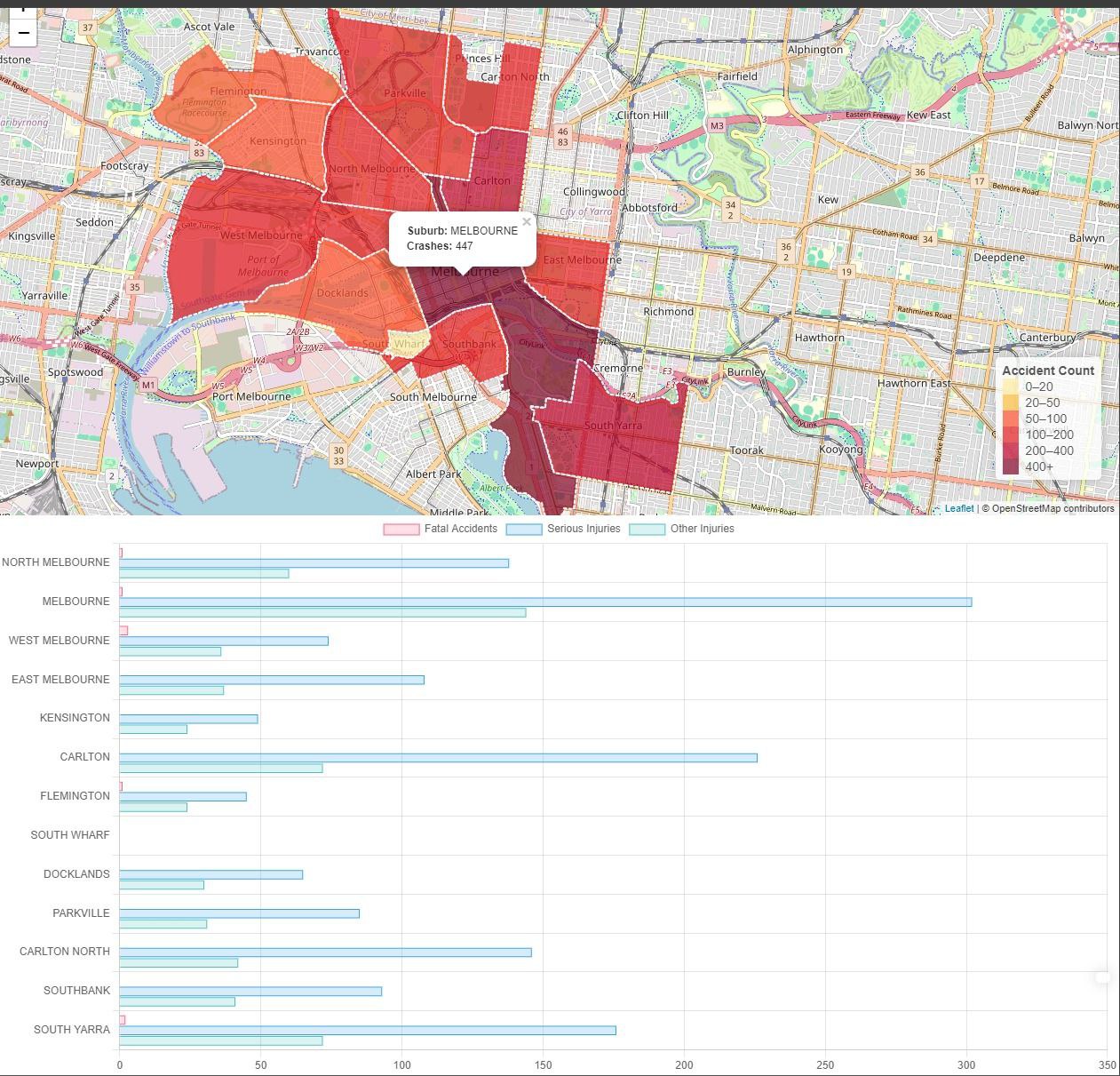
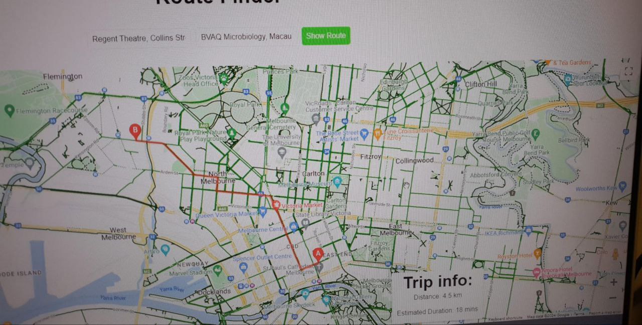
- Interactive map displaying recommended cycling routes and travel time between input locations.
- Highlight published bike paths and marking high-risk/danger areas based on past accidents data to assist anticipation.
- Markers included colour codes for severity and incident details for users to better understand potential risks for their own mitigation.
- Compilation of articles and websites for current and relevant regulations, news, and safety recommendations for cyclists in Melbourne.
Product
Website developed using the Django framework with a PostgreSQL database.
Personal Contributions
- Built data extractors in Python to Extract, Transform, and Load data onto a PostgreSQL database.
- Create route finding map, incorporating the additional hazard markers and layovers of published paths using Google Maps API.
Potential Improvements
- Add a summary section in the markers to highlight key threats or errors for and recommended actions to mitigate said issues
(AI - LLM APIs may be used to simplify and generalise the incident report content).
- Include a checklist for riders to fill before their ride or when purchasing bikes/equipment to start them out.
Note: Website is no longer active/deployed.